Historic Resource Mapping and Atlas Projects
Historic Resource Mapping
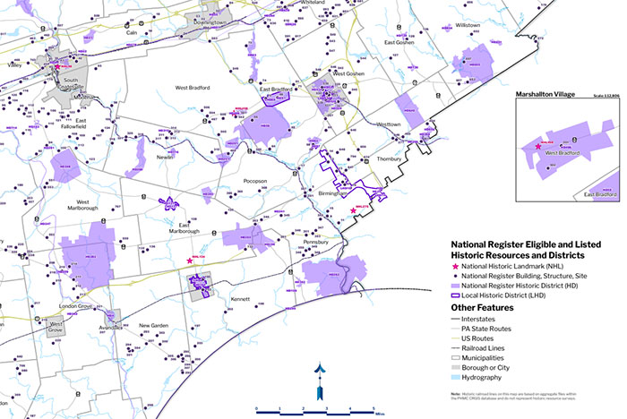
Chester County's character is largely defined by its historic resources and cultural heritage landscapes. In addition to hundreds of locally designated historic resources in our municipalities, Chester County ranks second in the state in the total number of individually-listed properties and districts listed in the National Register. Explore this map to find out more information about these National Register properties and districts.
Historic Resources Atlas Projects
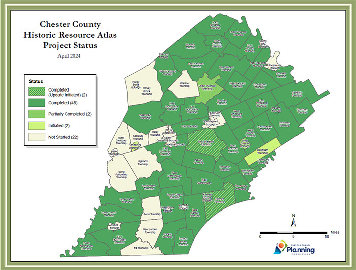
In 2004, an update to the original Chester County Historic Sites Survey (1978-1982) using a Geographical Information System (GIS) was initiated. This initiative is a partnership between the Planning Commission, Chester County Historic Preservation Network, and the municipalities. This project provides the first digitization of existing Chester County historic resources data and verifies the original survey data. The Atlas identifies historic resources (buildings, structures, sites, and objects) that are 50 years and older as a starting point and follows National Register of Historic Places criteria as a guideline. It is being completed on a municipality-by-municipality basis with the primary assistance of municipal historical commission members and interested volunteers and, in some cases, supplemented and expanded upon with the assistance of a professional consultant using County Vision Partnership Program grant funding. As of May 2020, 45 municipalities have completed Atlases and several other municipalities have Atlases underway.
1777 Chester County Atlas
The Chester County Archives has created an interactive property atlas representing property owners, the public road network, and points of interest (mills, taverns, fords, etc.), that existed in the county in September 1777. The Archives staff originally began this project to assist with the interpretation and preservation of the immediate Brandywine battlefield area, but they have since broadened their focus and now intend on researching and mapping all Chester County municipalities. View the 1777 Chester County Property Atlas portal, and stay tuned as it will be periodically updated as new municipalities are added.
Battle of Brandywine Animated Mapping
As part of a grant from the American Battlefield Protection Program, an Animated Battle of Brandywine Action Map was created in 2010 and updated in 2019. The Animated Map is an excellent educational tool that shows a general overview of the battle. The animation is divided into two parts.


