Design Elements — Maintain Existing Character and Context
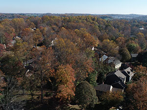
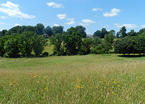
In rural areas in particular, maintaining the open space in its current use can be a major factor in preserving the character and landscape of the community. Existing woodlands, hedgerows, orchards, or other non-intensive agriculture operations like hay production, row crops, and produce can be compatible with conservation subdivision development if incorporated in a context-sensitive way. Allowing land to remain in agriculture, especially in areas with prime agricultural soils, allows farmers to continue producing and protects the viability of the fertile soil.
Ordinance Considerations
Hierarchy of Uses
Ordinance standards should set the priorities for the use of open space, indicating a hierarchy of most desirable uses. Specific uses permitted in the open space should be spelled out in the ordinance. Requirements for the size and shape of the open space should be included to ensure that the land provided is usable for its intended purpose. The standards should indicate if any of the open space must be accessible by residents of the development and/or the public, and if so, how much. Location of open space can contribute to whether the open space is perceived as being a public amenity or an extension of a resident's private backyard, so design and location should be carefully considered.
Sewage Facilities
Permitting sewage facilities (or a portion of them) in open space allows for alternative conservation subdivision designs versus conventional subdivisions. Refer to the Sewage Facilities design element for more information.
Prohibited Uses
The ordinance should state the specific uses that are not permitted in the open space. Under limited circumstances a structure may be permitted within the open space (e.g., a barn or historic structure) but the footprint of the building should be netted out from the open space requirement. The open space standards should be located within the article regulating conservation subdivisions in the zoning ordinance.
Sample Ordinance Language for Open Space Uses and Design
Preferred Purposes of Open Space
Areas designated for open space shall be configured as far as possible to meet the following purposes in the order listed*:
Note: A municipality should create its own prioritized list of preferred purposes of open space.
- Maximize the conservation of site features identified as having particular environmental, historical, or recreational value, including: steep slopes, floodplains, watercourses, wetlands, mature trees or specimen vegetation, areas included in the Pennsylvania Natural Diversity Inventory, woodlands, hedgerows, historic sites or structures, and other noted landscape features as identified in the Open Space, Recreation, and Environmental Resources Plan.
- Preserve agricultural uses and Class I, II, and III agricultural soils as defined by the U.S. Department of Agriculture.
- To the maximum extent possible, the open space shall be configured so that the view of the built portion of the proposed subdivision from public roads is minimized. The post-development view of the site from the road should be as similar to the pre-development view as possible.
- Provide links to open space or recreation areas on abutting parcels, including pedestrian trails, to create linked pathway corridors in the municipality. Open space shall be configured so that it is adjacent to or directly across the street from as many of the subdivision's residential lots as possible.
- Implement applicable open space and recreation plans of any federal, state, county, or regional organization, local municipality, or recognized private organization to complement and extend such resources in the municipality, where such plans are deemed to be acceptable and desirable to the municipality. Open space may also serve the purpose of providing buffers or transitional areas between the subdivision and adjoining parks or protected lands.
- Improve accessibility for the general public to the recreational facility or open space resource and promote its use among residents. To meet this purpose, pedestrian pathways shall be provided, where deemed appropriate by the municipality, to provide the potential for interconnecting pathway and sidewalk systems in the municipality.
Permitted Uses in the Open Space
Plans shall designate the use of open space and the type of maintenance to be provided. In addition to any of the uses meeting the purposes listed above in Subsection 1 as determined by the municipality, the use of common open space may include the following:
- Woodlands, meadows, watercourses, floodplains, wetlands, steep slopes, or similar conservation areas or wildlife habitat maintained in its natural state.
- Park or outdoor recreation areas, including existing or proposed trails, community gardens, and other low-impact passive recreation uses.
- Active recreation areas*, such as playgrounds, fields, and courts, provided such areas do not consume more than fifty (50) percent or a maximum of five (5) acres of the required minimum open space. The minimum pervious parking areas necessary to serve these uses shall be permitted in the open space. Active recreation areas shall be located so as to have the least impact on adjacent residential uses.
- Agricultural uses. Structures specifically serving and associated with these uses may be located in the permanent open space. However, the footprint of the structures shall not be counted towards the minimum required open space.
- Historic structures serving the purposes of Subsection 1.a above may be located in the permanent open space. However, the footprint of the building and any associated outbuildings or impervious surfaces shall not be counted towards the minimum required open space.
- Drip or spray application of treated wastewater solely from the tract development or, where applicable, that portion of the storm water management facilities determined to be eligible as open space.
- Stormwater management facilities that are designed to infiltrate stormwater, blend in with the surrounding landscape, and serve as an amenity. Infiltration basins, rain gardens, vegetated swales, and constructed wetlands are examples of facilities that may be eligible for inclusion in open space calculations. These facilities should be incorporated into the open space design with trails, benches, overlooks, attractive fencing, and native vegetation.
- Easements for drainage, access, sewer or water lines, wells, and underground utility rights-of-way. Above ground utility or street rights-of-way may traverse the open space but shall not count towards the minimum required open space.
Note: The municipality may want to require that active recreation areas be set back at least 100 feet from the nearest residential lot.
Note: A municipality should consider limiting the percentage of open space that can be used for drip or spray application of treated waste water.
Uses that Cannot Count Towards Open Space
Land occupied by the following uses may not be counted towards the minimum required open space although, if listed above in Subsection 2, the use may be permitted to be located within an open space area.
- Impervious parking areas.
- Sewage or water treatment facilities (except drip or spray application).
- Structural development, including buildings and stormwater detention basins, spillways, and level spreaders, shall not be calculated as part of the minimum required common open space area. Certain facilities, such as vegetated stormwater infiltration facilities designed as community amenities, may be allowed to count towards open space requirements if the governing body determines they would enhance or be consistent with the intent of the open space provisions.
Limits on Constraints in the Open Space
No more than sixty (60) percent of common open space shall be comprised of floodplains, wetlands, steep slopes in excess of twenty five (25) percent, waste water spray fields, and stormwater management facilities.
Limitations on Size and Shape of Open Space
Where open space is designated as separate, noncontiguous parcels, no single parcel shall be less than ten-thousand (10,000) square feet in area. In addition, the ratio of the longest to shortest dimension of an open space parcel shall not exceed five (5) to one (1). Exceptions to these standards are permitted where a portion of the open space is:
- A connecting strip between larger open space parcels, or a trail or portion of a trail network, in which case the minimum horizontal dimension shall be twenty (20) feet.
- Contiguous to a watercourse.
- Connects or includes sections designated on the "Recreation Lands and Facilities Plan" map of the Open Space, Recreation, and Environmental Resources Plan.
Note: Providing open space accessible to residents of the development may not be applicable in conservation subdivisions that only include estate lots.
Accessibility of Open Space
For cluster development designs that provide commonly owned open space, a minimum of twenty percent (20%) must be accessible and usable for residents of the development for passive and/or active recreation.*


